Location: Patuakhali, Bangladesh.
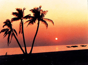
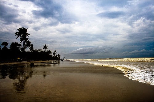
Kuakata (Bengali:কুয়াকাটা) is a panoramic sea beach on the southernmost tip of Bangladesh. Located in the Patuakhali district, Kuakata has a wide sandy beach from where one can see both the sunrise and sunset. It is about 320 Kilometres south of Dhaka, the capital, and about 70 Kilometres from the district headquarters. The Kuakata beach is 30 km long and 6 km wide.
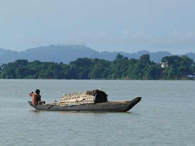
 The name Kuakata originated from the word 'Kua'-the Bengali word for “Well” which was dug on the sea shore by the early Rakhine settlers in quest of collecting drinking water, who landed on Kuakata coast in the eighteenth century after being expelled from Arakan (Myanmar) by the Mughals.Afterwards, it has become a tradition of digging Well in the neighborhoods of Rakhaine tribes for water. Kukata is truly a virgin beach – a sanctuary for migratory for birds a series of coconut trees, sandy beach of blue bay, a feast for eye. The unique customs and costumes of the ‘Rakhyne' tribal families and Buddhist temple of about hundred years are additional attractions.
The main tourist season is in winter but all over the year tourists visit this place. In Kuakata you can visit the life style of tribe Rakhains, who are very friendly to the tourist and visitors.
HOW TO GO
The road between Kuakata and Barisal is not as good as that between Barisal and Dhaka, largely due to extensive renovations. There is a small, barely identifiable ticket office diagonally opposite the Parjatan Motel that sells tickets for the bus to Dhaka (14 hours, 277 km, and daily at 1 pm). You'd be wise to book a day ahead.
| |||||
| Service Provider | Departure | Destination | Contact | ||
| Eagal Paribahan | Dhaka | Barishal | 02 - 7101504 | - | |
| Shohag Paribahan | Dhaka | Khulna | 02 - 9334152, 8316766 | ||
| Green Line | Dhaka | khulna | 02 - 9339623, 9342580 | ||
There are also direct connections from Barisal to Khulna (eight hours). The trip, involving two ferry crossings, is via Bagerhat.
| |||||
| Service Provider | Departure | Destination | Contact | ||
| Bangladesh Railway | Dhaka | Khulna | 02-9358634, 8315857 | ||
| |||||
| Service Provider | Departure | Destination | Contact | ||
| GMG Airlines | Dhaka | Barisal | 02 - 8825845-9 | ||
| Air Parabat | Dhaka | Barisal | 02 - 9567056 | ||
| ||||||
| At first arrive Bangladesh and then pick one way for your destination | ||||||
ACCOMMODATION
| |||
| Service Provider | Address | ||
| Parjatan Holiday Homes | Kuakata, Phone: 88-0441-64433, Cell: 88-01715167936 | ||
| Hotel SKY Palace Ltd. | Kuakata, Potuakhali, Mob: 88-01727030248, 01716749027 | ||